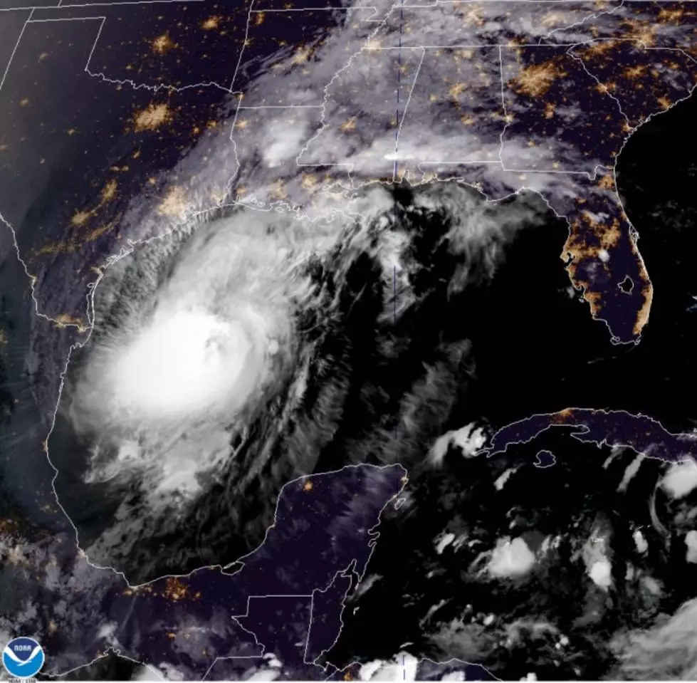
Hurricane Delta to Make Landfall Friday Afternoon
For the 5th time this summer, a tropical event is happening in the Gulf of Mexico as Hurricane Delta will reach the Louisiana Gulf Coast by tomorrow afternoon.
The Crossroads is once again just outside the cone as it appears Hurricane Delta is headed right for the same area that was hit so hard by Hurricane Laura back in August. The Beaumont, Texas, and Lake Charles, Louisiana areas appear to be in the crosshairs once again for heavy rains, flooding, and tropical force winds.
Hurricane Delta is expected to make landfall as a strong Catagory 2 hurricane. The path for Delta shows the storm strengthening to a Catagory 3 hurricane and then weakening slightly before landfall. While the National Hurricane Center's latest update suggests a Catagory 2 Hurricane at landfall, things could change by Friday afternoon.
Due to the close approach of this storm, we will have to watch this storm carefully as it passes. Those in the watch area should complete preparations for the impacts of a tropical storm.
While Hurricane Delta is expected to make landfall in Louisiana it is expected to bring large swells, rip currents, and moderate coastal flooding to parts of Texas beginning this evening and throughout the next couple of days.
Tropical Force winds from Hurricane Delta are moving into the area overnight and into Friday morning. Delta was showing maximum sustained winds of 115mph on Thursday afternoon. Time to tie down that backyard trampoline if you are over in the Galveston/Houston area.
Current Watches and Warnings for the area include:
- High Rip Current Risk from Port O'Connor to Corpus Christie through Friday evening.
- A Coastal Flood Warning for Aransas Islands, Kleberg Islands, Nueces Islands, and the Calhoun Islands.
- A High Surf Warning through 7 PM Friday. for Coastal Willacy, Coastal Cameron, Coastal Kenedy

KEEP READING: What to do after a tornado strikes


