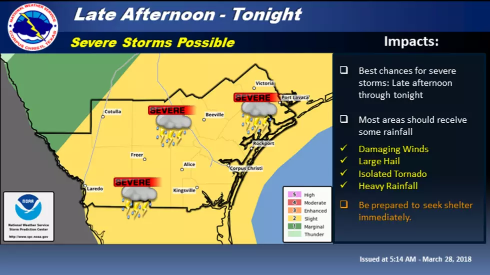
Severe Weather Possible Tonight
Much of today should remain dry across South Texas. However, an isolated thunderstorm or two may develop this afternoon across primarily inland areas. If storms do develop this afternoon, they will have the potential to become severe with large hail and strong winds being the primary storm threat. We will monitor this situation during the day.
The better chance of showers and thunderstorms will occur this evening into the overnight hours. Coverage of thunderstorms should increase this evening over the Rio Grande Plains and Brush Country and then develop eastward towards the coast tonight. Strong to severe thunderstorms will be possible with this activity. The main threats will be large hail and damaging winds, but a low tornado threat will also exist. Conditions will begin to improve early Thursday morning as thunderstorms shift east of the area.
In addition, long period swells and moderate southeasterly winds will result in a high risk of dangerous rip currents today along Gulf-facing beaches. Strong to potentially life threatening rip currents are expected through early this evening. Rip currents can be hazardous to even experienced swimmers.
South Texas Impacts:
Winds: Damaging winds in excess of 60 mph. Damage to mobile homes, porches, and awnings will be possible. Large fallen trees may produce scattered power outages.
Hail: Large hail greater than 1". Hail may cause damage to vehicles in the form of chipped paint, dented body panels, and broken windshields. Damage may also occur to vegetation and roofing shingles. Anyone caught outdoors could face serious injury.
Tornadoes: An isolated tornado or two will be possible.
Rainfall: Some locations may receive 1 to 3 inches of rain with isolated higher amounts possible. Quick ponding of water occurs at underpasses, low-lying spots, and poor drainage areas. Storm drains and retention ponds may become near-full and begin to overflow in a few places. Flood waters may prompt brief road closures.
More From KLUB Tejano 106.9


