Texans Know Mid-September Means a Busy Tropical Outlook
Just one look at the Friday morning tropical outlook in the Atlantic and it's not hard to guess what month these images are from. We are in the peak of hurricane season now, and the images from the National Hurricane Center show the Atlantic Ocean is having an unprecedented year for activity.
The National Hurricane Center has issued travel advisories for Tropical Storms Paulette and Rene in the central and eastern tropical Atlantic.
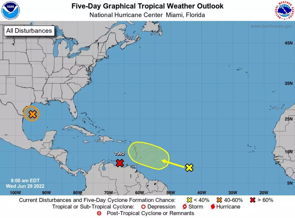
Much closer to Texas are a couple of systems that could end up in the Gulf of Mexico in the blink of an eye. Low pressure over the Bahamas is kicking up some organized storm activity that extends for over a hundred miles into the western Atlantic. This system is expected to enter the Gulf of Mexico by tomorrow. This system is the orange "X" nearest to the Florida coast in the photo below.

That yellow "X" is also worth keeping an eye on this weekend. It's a trough of low pressure over the North/Central Gulf that has a low chance of developing over the weekend. Still worth keeping an eye on considering how close it is with room to grow.
Over the weekend in Victoria county, we will see temps back into the mid-90s with some shower and thunderstorms entering the picture by Sunday afternoon. A great way to keep up with all the weather updates we are tracking here at the radio station is to grab our free mobile app. Enter your number into the box below to start the free download. Be sure to approve your preferred notifications so the info makes it to you as soon as possible. Enjoy the weekend!

ALSO: PEEK INSIDE JON BON JOVI'S NEW $43 MILLION PALM BEACH MANSION
More From KLUB Tejano 106.9