Western Gulf of Mexico Coming to Life Early This Year
Well, it looks like mother nature is stirring up the tropics a little early this year. Hurricane season doesn't officially start until June 1st, but it looks like we already have a couple of areas of interest. Including a disturbance in the western Gulf of Mexico.
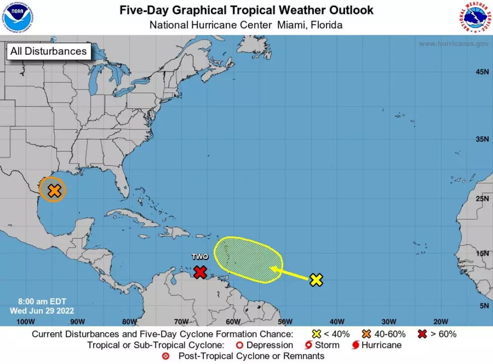
Here is the latest: The disturbance in the western Gulf is now an invest area - Invest 91L. The latest information from the National Hurricane Center is that a low-level circulation appears to be forming, thus the odds of development have increased to 40% (medium chance). However, looking at satellite imagery, convective (thunderstorm) activity is limited this morning. Conditions are marginally conducive for development, and it is possible Invest 91L could develop into a tropical depression or weak tropical storm before moving into Texas tonight. Regardless of development, more rain can be expected for parts of Texas and Louisiana.
As of now, the Crossroads could see an increase in rain chances as a direct effect of this disturbance. The coastal areas could see flooding and an elevated risk of rip currents and increased swells. Be sure you check back for updates as conditions are always changing when it comes to tropical situations.

KEEP READING: What to do after a tornado strikes
More From KLUB Tejano 106.9