Tropical Update: Tropical Storms Paulette and Rene
2020 continues to be one of the busiest years on record in the Atlantic as two more Tropical Storms have developed and are being tracked by the National Hurricane Center and the National Weather Service.
The good news? These storms appear to be more bark than bite. It will take until the end of the week for these two storms to really strengthen. By the looks of the forecast models below, both storms show little chance of ever reaching the U.S.
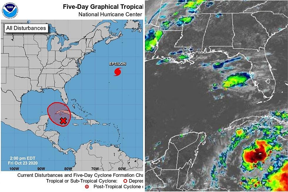
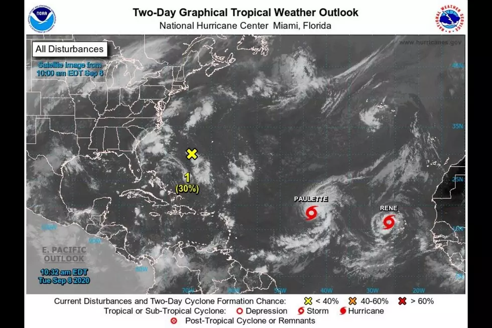
Tropical Storm Paulette is moving NorthWest at 6 MPH with maximum sustained winds of 65 MPH. This storm appears to be headed West across the Atlantic but will end up spinning North and blowing back out to sea before it really ever gets that close to the east coast.
Tropical Storm Rene is moving West across the Atlantic at 16 MPH with Maximum sustained winds at 40 MPH. Rene also appears to be headed North instead of towards the Caribbean. Both of these storms would need major developments in the next 2 to 3 days for a change in course to occur. For now, we will keep an eye on them but try not to stress too much as right now they appear likely to not impact us here in Texas.
Over the next couple of days in South Texas, we will be looking at rain chances near 50% with Showers and Thunderstorms. High temperatures over the next couple of days will be near 90 degrees.

CHECK IT OUT: These words were born in the '80s
More From KLUB Tejano 106.9